If you’re headed to Overland Expo West from Southern California, it’s always a good idea to take a dirt detour and make the trek a little more adventurous. Copper Bottom Pass and the El Paso Pipeline Road are just south of the off I-10 highway and are a great way to grab a little dirt time on your way to Flagstaff. This route will take you from the Colorado River Basin, through some rugged desert terrain, and across the Kofa National Wildlife Refuge.
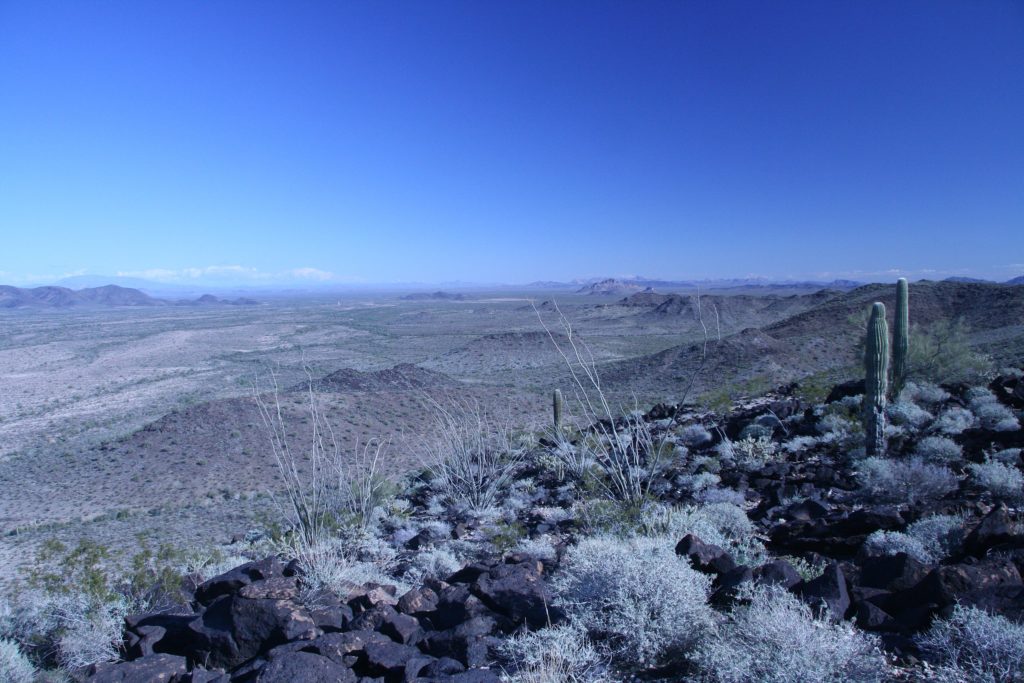
If you’re coming from the west, the route begins just over the California state line in Ehrenberg, Arizona, where you’ll take the Ehrenberg Cibola Road south and follow a series of dirt, sand, and gravel roads east. Copper Bottom is sandwiched between two passes and dotted with Arizona mining history. Copper Bottom Mine to the north is gated off, but the old mining structures are visible throughout the area. The passes offer sprawling views to the east into La Paz Valley towards the Kofa Mountains and west towards the Colorado River basin.

When you cross Highway 95, continue the journey east on Blevens Road. This short, 6-mile stretch of dirt takes you into the Kofa Wildlife Refuge. The refuge was established in 1939 for the protection of desert bighorn sheep and other native wildlife following a 1936 campaign by the Arizona Boy Scouts. The preserve encompasses over 600,000 acres of Sonoran desert and is home to a vast array of wildlife, including desert bighorn sheep, Sonoran pronghorn, roadrunner, desert tortoise, and desert kit fox.
READ MORE: How to Overland During Winter: Keeping Warm
Blevens Road connects to El Paso Pipeline Road to carry you across the rest of the refuge. Along your ride through the refuge, you’ll notice numerous side roads to extend your adventure, including Wilbanks Road and the Kofa Manganese Road. These detours are a bit more challenging than the Pipeline Road, but if you’ve got the time and skill, make for fantastic desert exploring. For a quick detour, take the spur to Jasper Springs a mile south to Kofa Cabin, a lovely stone structure built by the Civilian Conservation Corps in the 1930s.
As you make your way east and leave the Kofa, the Eagletail Mountains come into view. This rugged range is only about 25 miles long but boasts 39 distinct peaks, including the imposing Courthouse Rock. The Eagletail Mountains Wilderness was named for the jagged spires on the summit of Eagletail Peak, and the area adds some stunning desert texture along this route.
This entire route is a fantastic way to avoid the monotony of the highway between California and Arizona and drops you into some truly remote desert landscapes. None of the Copper Bottom Pass or El Paso Pipeline require technical driving, but having a capable vehicle and being self-sufficient in these areas is essential.
What to Know:
- Time: 6-8 hours
- Distance: 78 miles
- Fuel: Gas is available sporadically at numerous locations along I-10 and in Ehrenberg before you hit the trail.
- Highest elevation: Elevation along this route tops out at 2200 feet. Be prepared for desert temperatures and an arid climate.
- Water: There is no water along this route, so pack more than enough to stay hydrated for the duration of your trip.
- Camping: Ample dispersed camping is available along this entire route. Please pack out anything that you bring in with you.


