Overlanding is always about the journey, but the journey isn’t much fun if you don’t know where you are, how to get to your intended destination, or how to get back if trouble occurs. There are a ton of fancy electronic mapping tools for your phone and a wide range of handheld GPS devices designed for use in places where there is no cell phone signal. Relying on just a phone app or GPS device when out in the backcountry is a very dangerous mistake. We’ve also seen GPS units fail or apps not work because users forgot to download offline mapping information. What then?
It is important to carry multiple methods of navigation – including good old analog folding maps and a good compass – when you’re exploring. When heading off the beaten path in four wheels or on two, these are our choices from getting to your destination – and safely back home again.
Garmin Montana 700i GPS with inReach
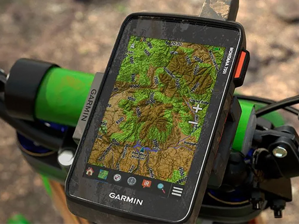
Garmin has been making inReach GPS devices for several years now, allowing off-roaders and overlanders to stay in touch by texting via satellite. And while the inReach Mini is a popular option, the Garmin Montana 700i is a do-it-all off-road option with a long list of features, the latest tech, and familiar smartphone-like operation. As such, it can be mounted on a motorcycle, ATV, UTV, bicycle or in your vehicle using a simple smartphone mount.
It’s built tough, with a durable, water-resistant chassis tested to U.S. military standards. The screen size has been enlarged 50% over the old Montana model and it can also bring you weather reports and even track your furry friends when paired with Astro or Alpha units. The Montana 700i works like a standard handheld GPS, but an inReach subscription plan is required for texting via satellite.
MSRP: $699.99
Garmin Overlander GPS Tablet
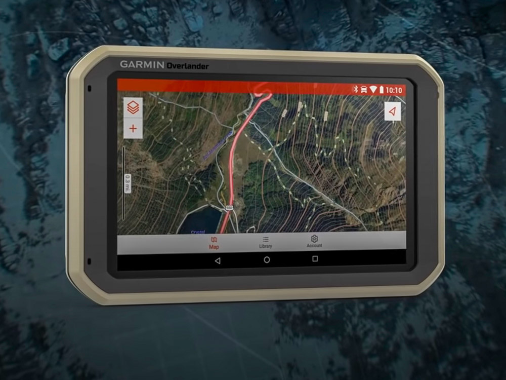
Got a big rig? Garmin’s $699 plus-size Overlander GPS is more than a device to show you where you’re going. Based on a tablet PC, it has a wide range of features built-in, not the least of which is the sprawling 6.95-inch touchscreen. There’s 64gb of internal memory for downloading maps, and a micro-SD card slot for adding more memory as needed. It can also work as a backup camera with a Garmin BC-35 wireless backup camera.
And it’s built tough, with an impact resistant outer casing made to military standards. It will also connect to the Garmin PowerSwitch module to give users touch-screen control of lights and other gear. A built-in pitch and roll angle display helps keep your wheels on the ground, and it can also record your track so you can find your way back if conditions decline. It will also pair with Garmin InReach devices for quicker texting via satellite in an emergency.
A strong magnetic mount with power coupling is included, and the large internal battery will run the Overlander for hours on its own.
MSRP: $699.99
Butler Maps – Motorcycle Maps
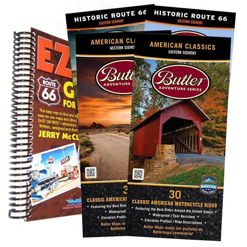
Butler’s amazing maps are tailored to the needs of motorcyclists, but anyone can appreciate the huge amount of work that goes into them. Butler’s ride crews have ridden tens of thousands of miles to find – and then rate – the best roads and backroads for motorcycle riders, along with POIs and other stops along the way. The back of each map includes enlarged maps of cities, helpful local information, and stops you definitely want to hit along the way.
The maps are available in regions, points of interest, specialty editions (Route 66, etc.) or in a large bundle covering the entire United States, including BDR routes and BDR-X loops. The maps are waterproof, specially laminated, tear-resistant, easily foldable and pack easily into your tank bag, tail bag or jacket pocket. There’s a reason they are more popular than ever.
MSRP: $14.95-$253.00
DeLorme Atlas and Gazetteer Maps
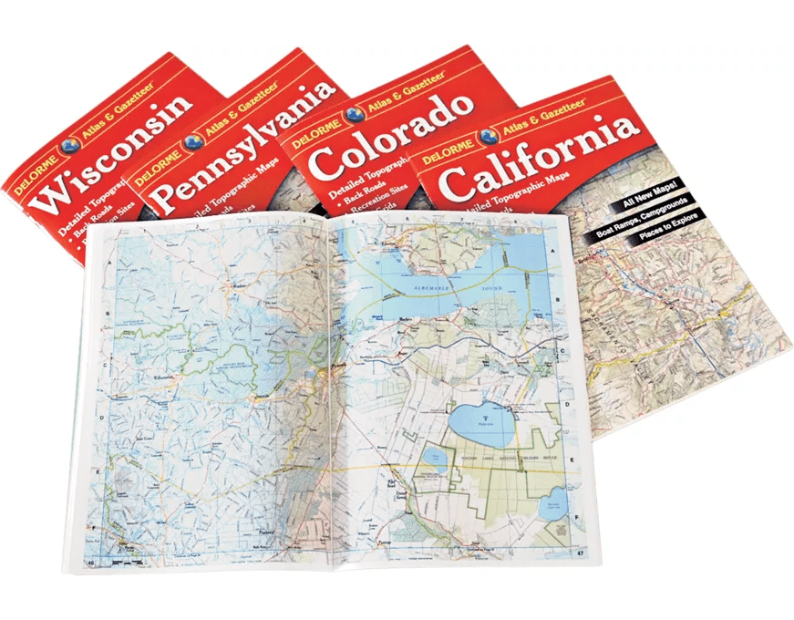
While Butler makes top-spec motorcycle maps, DeLorme Atlas and Gazetteer Maps cast a wider net and support every kind of vehicle. They are super reliable and made of paper, and they don’t need to be charged up. DeLorme offers maps for every U.S. state with detailed information on landmarks, state and national parks, rivers, campgrounds, hunting areas, and pretty much every piece of relevant outdoor information. They’re in full color, as well, making them easier to read and distinguish categories. Available by state and region.
MSRP: $24.95
Read More: Review: Kakadu Outback Shower System
Suunto MC-2 Compass
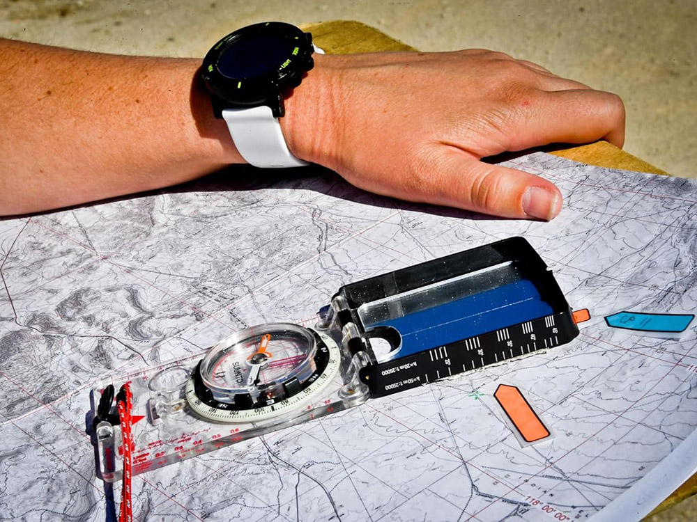
Paper (or laminated) maps are only good if you know how to use them. A better combination is to carry a map and an old-fashioned (non-digital) compass. Fast, simple, and accurate, the Suunto MC-2 Compass includes a liquid-filled capsule for stable operation and a declination correction scale to cover all recreational uses. It also has a mirror for off-axis readings and to use as a signal for help. The compass is balanced for the northern hemisphere, so our readers in the southern hemisphere should buy one calibrated for their needs. Buy a compass and learn to use it. It could save your life.
MSRP: $70.00
Garmin Tread XL GPS – Overland Edition
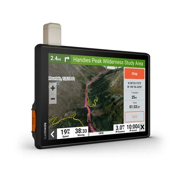
Garmin has a long reputation for making reliable GPS devices for street travel, but the Garmin Tread XL takes that a step further by giving directions off the road. The 10-inch display uses similar software to other Garmin devices for easy-to-use driving directions to get to your destination. But once off the road, it features useful tools to help find campsites, roads, weight and size limits for vehicles, and topographic information. The Tread XL – Overland Edition includes inReach technology, so you always have global satellite communication in the event of an emergency. An app can also load maps from the USGS. And it all comes encased in a tough package that can withstand weather, dust, and shocks. It’s a durable device that can be used just about anywhere.
MSRP: $1499.99
OnX Offroad Smartphone App
If you want to minimize the electronic devices you bring in the outdoors, consider the Offroad App from OnX. The service is updated daily with information on trails, campsites, and road changes to prevent as many surprises as possible on your way to your destination. The app includes information covering 985 million acres of public land, as well as more than 54,000 campsites and 35,000 miles of trails. Better still, you can download maps you need and pre-program your own points of interest for when your smartphone loses signal.
MSRP: 7-day free trial/ $34.99 per year
Gaia GPS Smartphone App
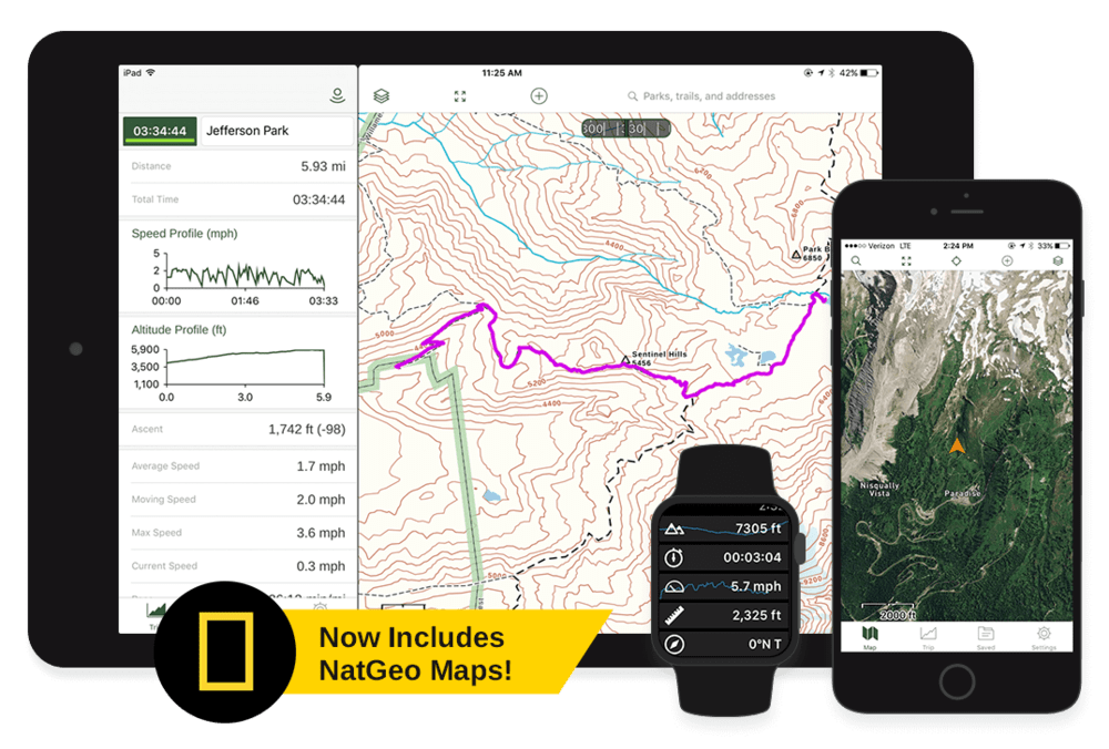
Gaia GPS broke into the space as a useful mapping tool for trails and hiking, but Gaia is also a useful tool for vehicular backcountry travel, with various mapping layers and topographic information built into the app. Users can download maps, create waypoints, and share .gpx files with others in their group. Better still, it works with an Apple CarPlay or Google Auto-compatible vehicle head unit, meaning it’s easier than ever to use before you get on a trail. Recent changes include an improved interface and more device compatibility.
MSRP: Free – $36.00 per year
Route Planning: FunTreks Maps
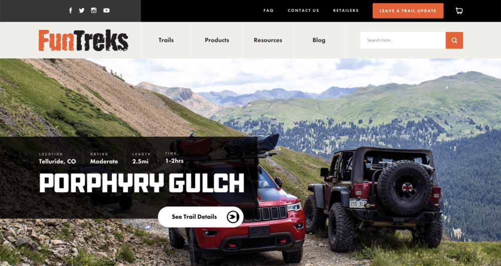
FunTreks offers custom-designed map books and digital GPS maps that feature off-road trails that have been tested by experts – similar to how Butler Maps creates its maps and guides. Their books differentiate various trails based on difficulty, which are accompanied by detailed photos and turn-by-turn directions to make sure you don’t tackle more than you can handle. Currently, FunTreks guides are available for Arizona, California, Colorado, and Utah. There is a special book dedicated to Moab as well.
MSRP: $34.95– $74.90
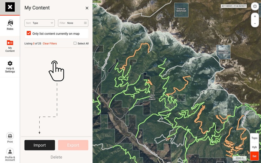
Route Planning: Trails Offroad Maps
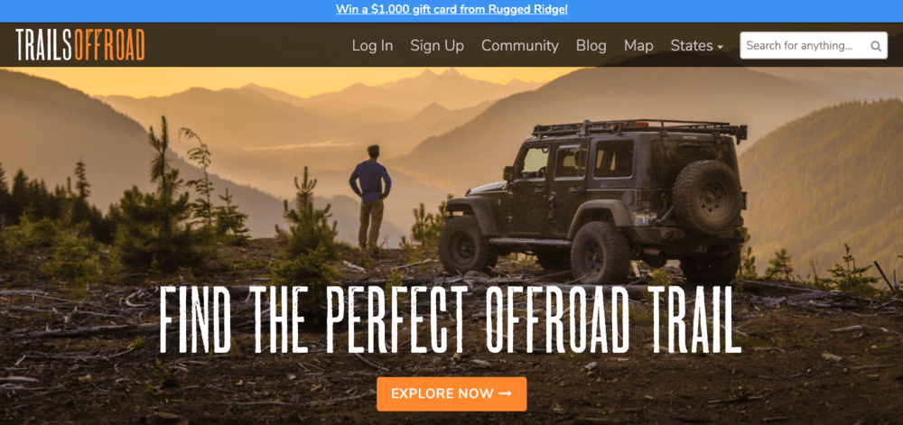
Part of a successful overland journey is pre-planning while you’re still at home. Trails Offroad makes that task easier by giving you access to maps with tracks color-coded by difficulty backed by an advanced trail rating system. The ratings differentiate trails by difficulty level and include detailed route descriptions plus all the waypoints Trails Offroad has in its database. Users can generate shareable GPX files with waypoints, including obstacles, campsites, and historical points of interest; and advanced search capabilities. Get your planning done quickly – and perhaps discover some new things to see on your next trip!
MSRP: Free or $25.00 annually
ZOLEO Satellite Communicator SOS Device
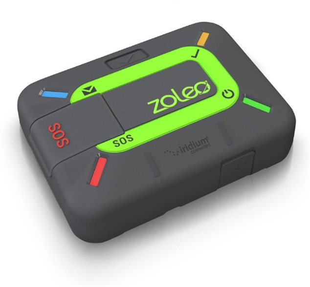
The small, rugged, and award-winning ZOLEO satellite communicator connects with your smartphone or tablet to offer seamless global 2-way messaging wherever your adventures may take you. With over 200 hrs. of battery life, it provides reliable access to 2-way messaging, check-ins, weather forecasts, location sharing, and SOS alerting everywhere on Earth.
MSRP: $200.00
Read More: A Colorado Adventure in the Ultimate Overland Vehicle
SPOT X Satellite GPS/SOS Device
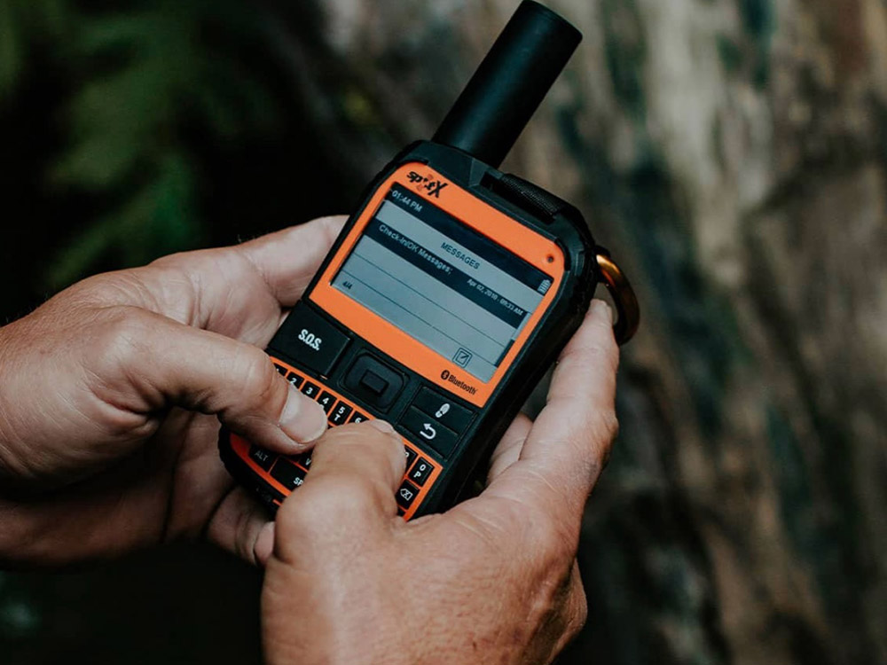
Like the larger Garmin inReach devices, the $249 SPOT X is a full-on GPS and communication device that bounces text messages off of satellites anywhere on Earth except the polar regions if you can see the open sky. However, it has a hard keyboard, and the device is toughened for outdoor use, including an IP67 rating for full submersion for up to 90 minutes. It can also link to a smartphone for expanded functionality. The low-res monotone LCD screen is sharp enough for map work but draws very little power, so it will run for up to 10 days on a full charge. There is also a built-in compass. Texting via satellite requires a service plan that starts at $15/month.
MSRP: $249 + Service Plan
SPOT Trace Tracking Device
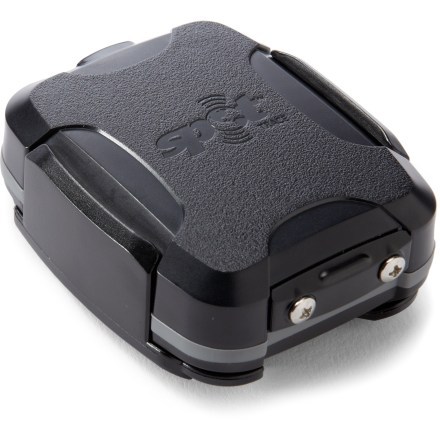
The SPOT Trace can keep track of you or your belongings when you leave them behind. In intervals of minutes or hours, the Trace sends updates to your phone using GPS signals to give a status update on movement with real-time coordinates. It’s a light 3.1 ounces and works in extreme temperatures – as well as being submersible for up to 90 seconds. Service plans run between $10 and $13 per month, so it’s a reasonable fee for making sure your expensive property stays where it’s supposed to be.
MSRP: $129.95 + service plan