There isn’t a trip that is more uniquely Northern California than the Lost Coast, a collection of mostly dirt roads that starts at Highway 1 between Westport and Leggett and traverses CA State Land Trust lands and Sinkyone Wilderness State Park which includes a collection of beautiful hikes, beach access, and (paid) camping at Usal Beach.
The area has gas and food available in Shelter Cove, Leggett, and in Fort Bragg, but as always be self-sufficient and bring enough to get you through.
The initial section of road (see above) is well-graded if not a bit narrow and you can expect to finish the 10 (ish) miles to Usal Beach in 20-30 minutes. The road here offers incredible views of the Pacific Ocean and awesome jagged cliffs that fall directly into the ocean – if it isn’t foggy, which it usually is …
The entire coastline here sits on one of the most seismically active areas of the planet – The Mendocino Triple Plate Junction – where the North American, Gorda, and Pacific plates come together. Geology nerds can geek out on this area for eons. This area was once slated to become Highway 1 but the seismic activity ended that idea rather quickly.
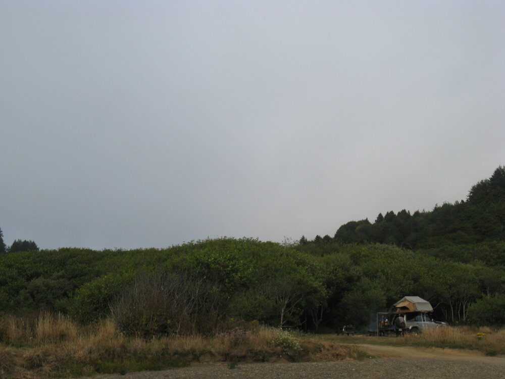
Photo: Anthony Sicola
Camping at Usal Beach is paid and there are payment envelopes and an “Iron Ranger” at the entrance to the camp. When we went it cost $25.00 per night, but the “Iron Ranger” was broken, so we wrote a check and waited for a ranger to come by our campsite to collect the money., which they did.
Because it is not well patrolled, doesn’t have a camp host, and doesn’t have trash pick up, it is on YOU to do the right thing and pack out your trash. Locals aren’t very good about it and the litter around the campsites is proof of this. I suggest visiting during the week as weekends are full of local talent driving too fast, playing music too loud, and drinking too much. Weekdays, you have the area all to yourself (and the herd of Roosevelt Elk that call the beach home.)
Leaving Usal Beach, you’ll take the wooden bridge that crosses Usal Creek and head northwest to another mostly well-graded, but slightly rutted dirt road that winds along ridges and through redwood forests to the end of Usal Road at Four Corners. From there you have a few choices; you can head west on pavement to the cool little town of Shelter Cove, but watch your descent into town – it is quite steep and your brakes will not like an overloaded vehicle, you can head north onto a dirt track into the King Range for more backcountry exploration or you can head east on the paved road to Highway 101.
WHAT TO KNOW:
Time: 3-4 hours
Distance: 30 miles
Fuel: Gas is available in Fort Bragg and Shelter Cove. Even if you fill up there, it’s advisable to bring a couple gallons of fuel along just in case.
Highest elevation: 2114 feet
Water: Although there may be water along the route, don’t rely it as your only water source. Plan to carry your own water. Plan for one gallon of water per person per day.
Permits: Permits are not required, but Usal Beach is a paid campsite. Do your part to help keep it open by packing out your trash.
Other considerations: Usal Road may be gated in fall and winter based on rainfall and road conditions. Check with CA Department of Parks and Recreation for more information.

Header image: Anthony Sicola