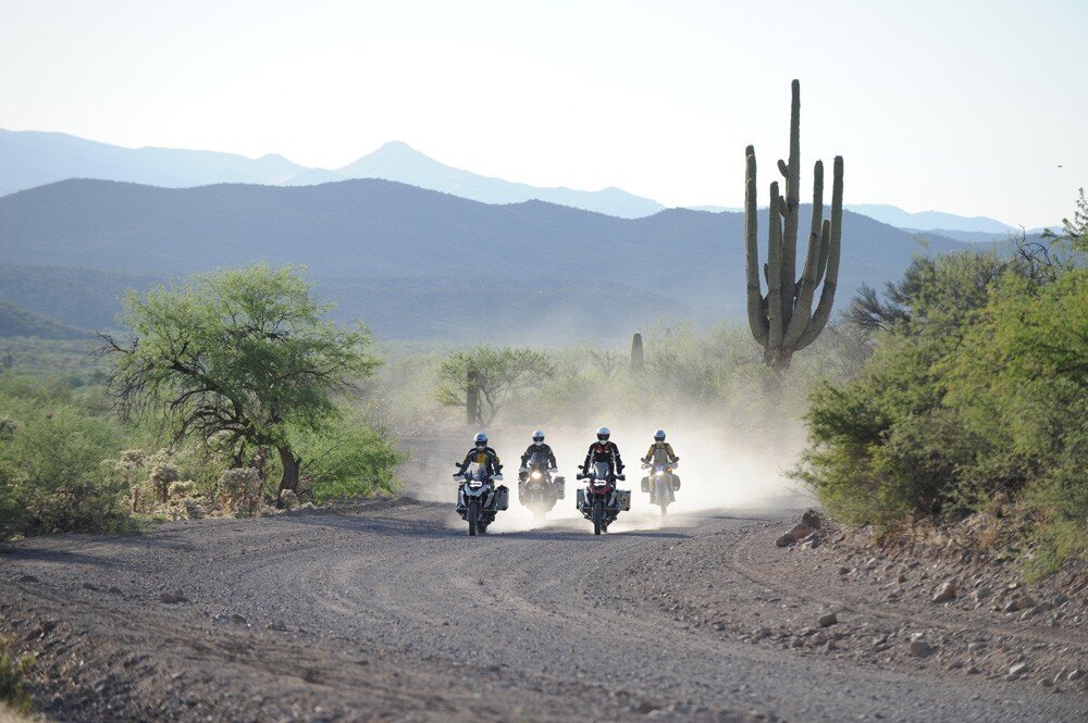
To the uninitiated, Arizona may seem like nothing more than a cactus-studded desert, but as soon as your tires hit the gravel on the Arizona Backcountry Discovery Route (AZBDR), you’ll see how incredibly diverse this state truly is. The AZBDR begins just a few miles north of Mexico, runs 750 miles to the Utah border, and sends you motoring through deserts, grasslands, and mountains alike.
Backcountry Discovery Routes is a non-profit organization that has been creating off-highway adventure riding routes for the last decade, as well as promoting responsible travel for motorcyclists in the backcountry. Though the AZBDR was designed for motorcycles, it is entirely on public roads and is generally navigable with a 4×4 vehicle.
READ MORE: GEAR COLLECTIONS: ADVENTURE MOTORCYCLE BOOTS
The AZBDR is divided into nine sections, many of which can be run as day rides. Of course, our preference is to take a week in either the spring or fall and ride the route in its entirety.

The AZBDR begins at the junction of the Madrean, Sonoran, and Chihuahuan deserts with a lovely climb up to 6500 feet of elevation through Coronado National Monument and a cruise along the border wall. As you journey north you’ll stay east of Tucson and make your way from deserts and saguaros to high elevation pine forests.
READ MORE: ALWAYS BE PLANNING A TRIP: THE UNIVERSAL LAW OF TRAVELERS
Further north, you’ll climb the Mogollon Rim, which marks the edge of the Colorado Plateau, and then traverse the volcanic lands around the San Francisco Peaks and Sunset Crater. The AZBDR has options to detour over to the ever-impressive Grand Canyon before heading into the Navajo Nation. In the final sections of the route, you’ll cross the Colorado River and wind through the Vermillion Cliffs before finishing the route at the Utah border.
The incredible variety of terrain on the AZBDR is one of the things that make it amazing. From ripping through volcanic cinders and sand, to climbing rock-covered mountainous slopes and cruising across high desert hard pack, this route has something for everyone. During the wetter months, you’ll have water crossings and it’s not uncommon to encounter snow in the higher elevations.
When you head out on the AZBDR, remember that this route has some definite challenge to it. Given the remoteness of the roads and the variability of Arizona weather and temperatures, it is best to ride with friends, keep your recovery gear accessible, and know your skills and limitations before setting out.
WHAT TO KNOW:
Time: 4-6 Days
Distance: 744 Miles
Fuel: Gas is available along each section of the AZBDR. The longest stretch between fuel stations is 136 miles, AZBDR Section 6 Young to Winona.
Water: Bring more water than you anticipate requiring — the high elevation and the arid desert have a way of drying you out. Plan on carrying plenty of water with you as desert water can be scarce.
Permits: You will need to obtain two permits for this route. The Arizona State Land Trust Recreation Permit is required for camping on and traveling through State Trust Land. A second permit is needed when riding through and camping in Navajo Nation (Section 8) and can be purchased at the small round building at the junction of Highway 64 and 89 in Cameron.
Other considerations: The website for the Arizona Backcountry Discovery Route has lots of good information and resources to start planning your trip, including more detailed route information and free GPS tracks to download.
Photo Credit: Backcountry Discovery Routes
Motorcycle & Overland Industry News by Eva Rupert. Follow Eva @augusteva.


