Fall Colors
Newfoundland Mountains, Box Elder County, Utah
Jason takes us behind the scenes of how and where his winning shot was taken in the Newfoundland Mountains of Utah.
It seemed like the entire population of Utah was flooding into the mountains to gawk at October colors. So, I, too, grabbed my camera, jumped in the Jeep and struck out. I had just two goals: 1. Get as far away from the crowds as possible and 2. Find some interesting landscapes for my lens. I only had three days, so the most difficult of the two goals was going to be finding a peaceful, isolated place to explore. As it turned out, I didn’t have to look very far. I took one quick glance at the map of northern Utah and found it: a completely isolated island mountain range smack dab in the middle of the Salt Flats of the Great Salt Lake desert.
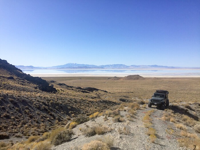
Utah’s rugged Newfoundland Mountains are so close, but yet so far away. The range is three miles wide by 20 miles long — not big by any means. And while it may be small in size, it is rugged and definitely isolated — just what I was looking for. Surrounded by the salt/mud flats, it’s further cut off from society by a USAF training and gunnery range to the south and east. So, just getting out here is difficult. Legally, there is only one way to get here: the long way.
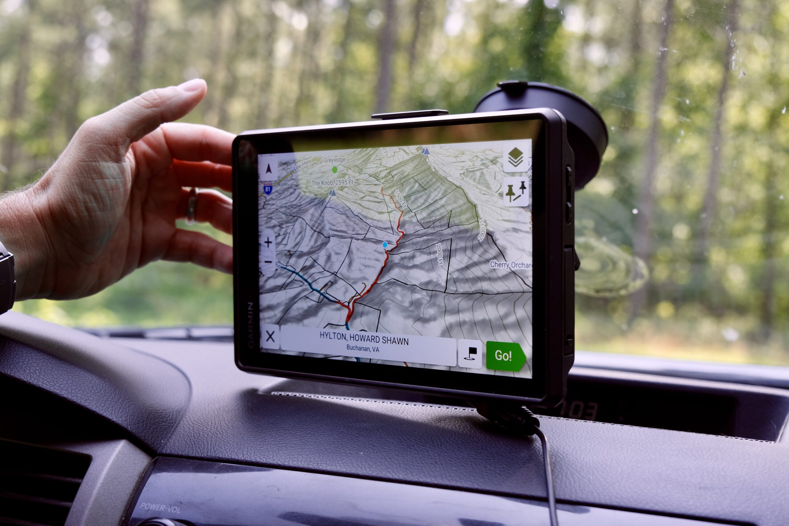
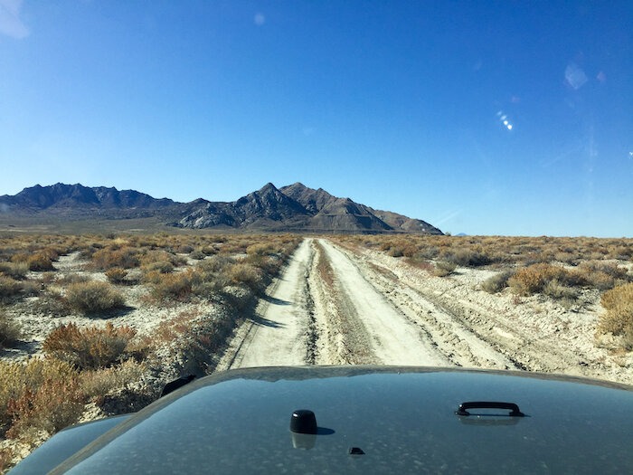
Traveling from Salt Lake City, I headed north on the freeway for 60-70 miles, and then west past The Golden Spike National Monument before the rubber finally left the pavement. From here it was another 50 or so miles west, weaving on and off of the historic Transcontinental Railroad bed, before turning south at the north end of the Hogup Mountains. Here, along the NW shore of the Great Salt Lake, things really began to feel remote. The chances of seeing another person became slimmer as each mile passed. Eventually, the gravel turned into two-track, travel slowed accordingly, and the hustle and bustle of the city life was left behind.
Occasionally, a rise in the road provides a glimpse of the Great Salt Lake. Recent dry years lowered the lake level. When the water here drops by even a foot, miles of mud flats are exposed. Because I was solo on this trip, I was beginning to feel the sense of isolation and risk — and I loved it. Cell service out this way is intermittent, making good choices was essential.
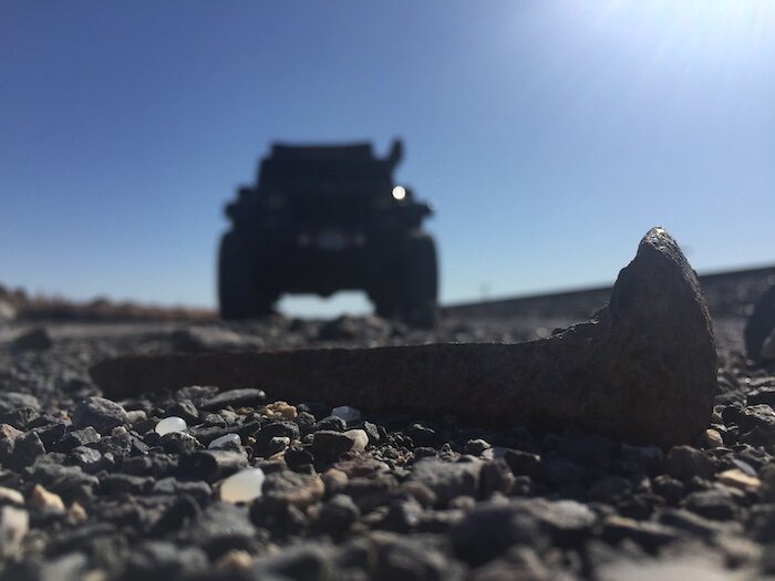
Another 40-50 miles down the shoreline, the road climbed a small ridge to the SW before dropping down to the southern tip of the Hogups. Here, the trail intersects the Union Pacific Railroad, a private road owned by Union Pacific. It follows these tracks across the GSL from the eastern shoreline all the way to Nevada. As I understand it, the public is only granted access to a section roughly 13 miles long, from the southern terminus of the Hogups to the northern reach of the Newfoundlands. That’s 13 miles of difficult-to-access, nearly arrow-straight, billiard-table-flat road. Straight and flat sure doesn’t sound like much, but this stretch comes with all manner of sharp metal objects that have been embedded in the road surface from more than a hundred years of rail maintenance. A good spare or two, a tire repair kit and a system to fill those tires are imperative. The odds of meeting a freight train along this stretch are also pretty good and there are only a few pullouts that will give you an extra 10 feet or so of separation.
Also located here, across the tracks at the western edge of the GSL shoreline, are giant pumps. Meant to lower the lake level during a period of high water during the 1980s and prevent future flood events, they were only in operation for a few short months. They have sat idle since. After some quick pictures of the pumping station and a passing freight train, it was time to air down my tires a bit more. This causeway, though flat, is plenty rough.
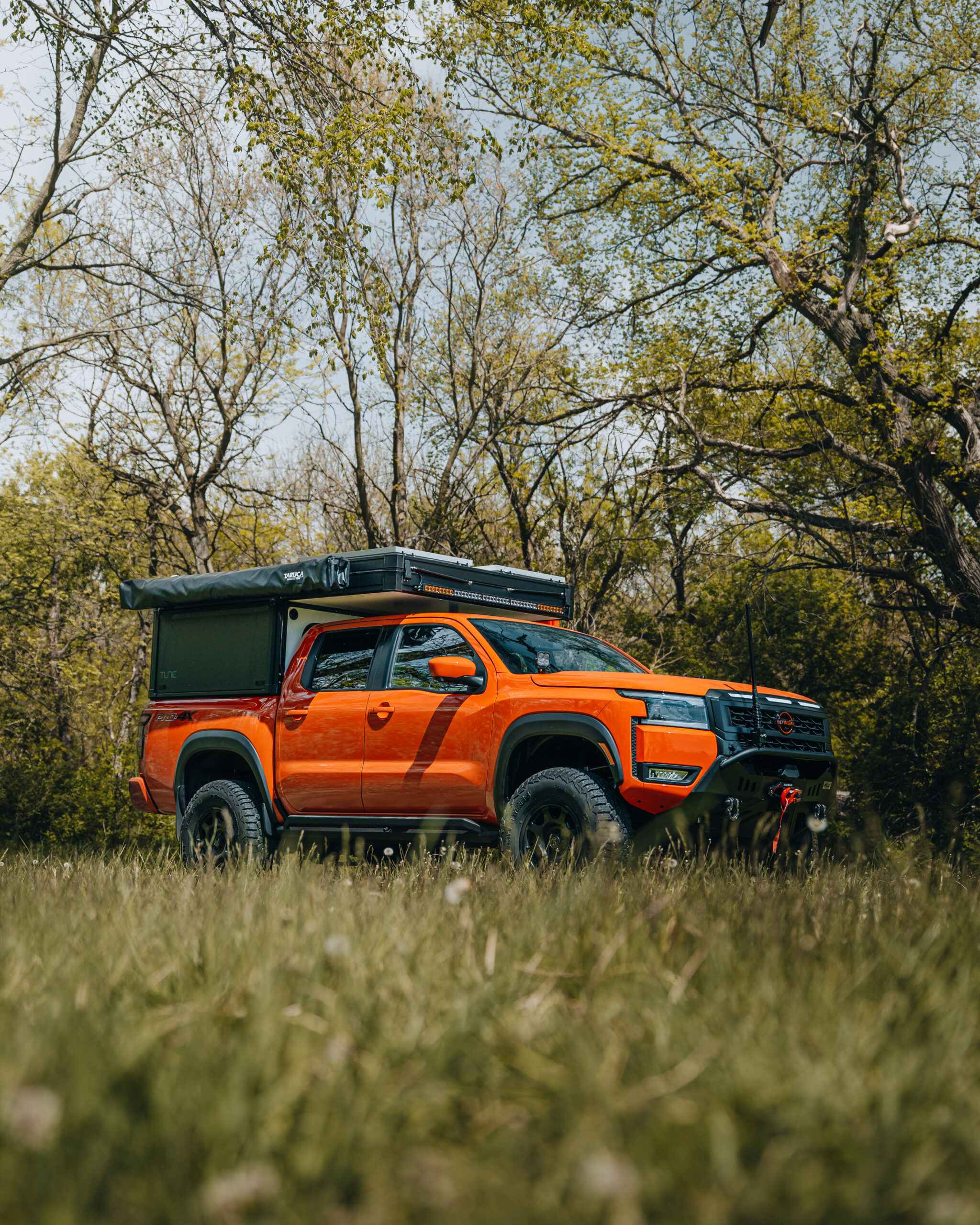
After nearly six hours of driving, I arrived at the crossing. The entire range lay to the south of me. Decent two-track roads flank both the east and west sides of this rugged bit of paradise. I planned to spend my first day exploring the western side, looking for any good sunset possibilities. I had serious doubts, though, as the sky on this day was a typical cloudless Utah sky (it’s great weather to live under but rarely provides interest from a photographer’s point of view). The travel was easy as the surface was dry and hard. The roads around the base very flat. The only issue, tall sagebrush and narrow tracks — not so great for the paint. No matter. I pushed on, passing three UTVs. I’m pretty sure they were headed out, as I did not see them or anyone else for the remainder of the trip. I had this entire place to myself.
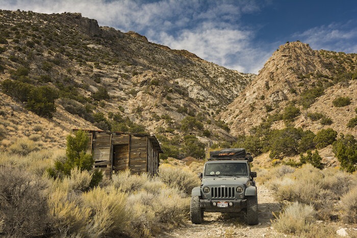
Moving south along the western slope, there was plenty to see. Old cars, the remains of many long-abandoned mines and the small camps that supported them litter this entire range. In the first big valley lies what’s left of Boston Terrace, a small mining camp with several old stone buildings and a number of shafts. Fully indulging my need to see what’s around the next corner, I kept moving, looking to gain some high ground for that sunset photo.
I found yet another faint track that climbed a small ridge near Big Pass. This was my first encounter with technical obstacles on this trail. Nearing what looked to be the last steep section before gaining the bench above, I came to a turn down into a steep wash. While it didn’t look to be much of a problem, I was alone and had promised my wife I would make smart decisions. I parked the Jeep and scouted all of it. It looked easily doable. The slope was quite a bit off camber and I was top heavy, but it still seemed manageable. I spent the next hour or so contemplating moving forward, after all decent camping was less than a quarter-mile up the hill. I waited here until the time of day forced a decision. I turned around. My available recovery gear and the size of my party dictated my move. I was a party of one with only a jack. That was a no-go for me. Turns out, it was a no big deal. I found a flat spot just down the hill and set up camp for the night.
I’d been out of the Jeep for a good bit, setting up the tent set up and prepping dinner when I began to realize how quiet it was — no wind, no birds, nothing. I hadn’t even heard a plane in the distance or the rumble of any trains to the north. This place was quiet. Perfect, I thought. I will sleep well.
Traveling light, I had brought only dehydrated meals. I wanted to maximize all my time for exploring so making anything complicated or having dishes to clean up was out of the question.
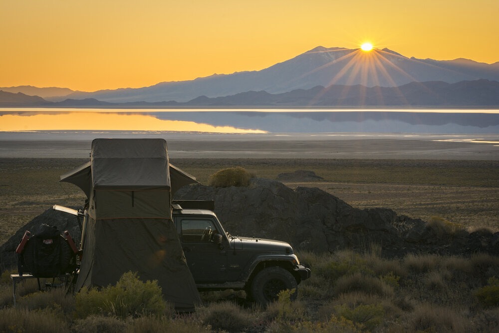
While the sun began to set, I pulled my camera out. During the day, the view to the west was haze-filled. And although the flats to the west were flooded, my hopes for a good sunset weren’t high. However, all of that changed, as the sun dipped behind Pilot Peak.
The next two to three minutes were incredible. Not a leaf in sight and I had all the color a photographer could ask for. It was in this moment I captured the image entered in the Best Shot Contest. It was a spectacular ending to a very long but enjoyable first day. I ate dinner and just sat in the silent darkness for the next hour or so. I sat in the silence long enough to realize that, if I listened hard enough, I could actually hear the ants scurrying over their little mound just a few feet away. Eventually, the silence became a bit disturbing, so I hit the hay for the night.
Sometime in the early hours after midnight, a huge boom rang out. I jolted from a deep sleep to wide awake, sitting straight up in terror. I was so fearful that I momentarily forgot I was camping. Whatever that explosion was, it sounded like it was no more than a hundred yards from the tent. Yet I heard no falling debris. I saw no flash. I heard no aircraft. I felt zero concussion from the blast. I like I had been after dinner, I was engulfed in deafening silence.
I recalled there was a military gunnery range to the south. So, I convinced myself that was the source of the blast. I lay awake for what seemed like hours after that, afraid to even move. Upon inspection the next morning, in the calming light of the Utah sun, I found nothing; there was evidence of anything having taken place near camp in the darkness. Even now, I’m still not sure if I dreamt the explosion or if it really happened. I know that I will never forget it, though.
At the end of the weekend I began heading home. Driving out the same way I came in… The long way.
Story and photos by: Jason Sims @jasonsims.ut