One-Tank Adventures are short trips, taken to hone your skills, keep your overlanding chops up, and lean into your immediate locale. Fill up once, do something awesome, get home before the gas light comes on.
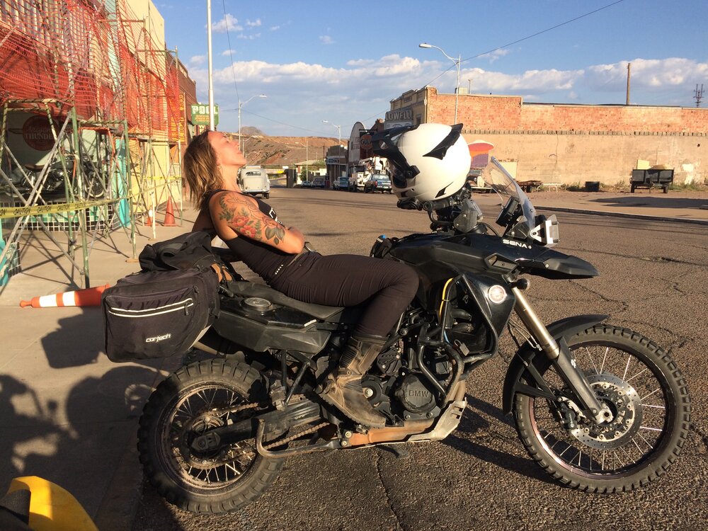
I happen to live in a place where the options for a One-Tank Adventure (OTA for those in the know) are exceedingly good. Down here in Southern Arizona, we’ve got deserts, forests, and, of course, Mexico — all ripe for exploring. My latest OTA was a spur of the moment ride inspired by the new set of knobbies that I mounted on my F850GS.
After a half-day of being shackled to the computer while working on various Overland Expo Virtual projects, I was more than itching to get out on a ride. With the October day waning quickly, my afternoon priority was to get myself someplace beautiful before nightfall and have a darn good ride in the meantime. I set my sights on the Chiricahua Mountains, just over an hour from my home in Bisbee, Arizona.
Obligatory moto selfie in the Chiricahuas.
The Chiricahuas cover a wonderfully remote swath of southeastern Arizona and are perfectly suited to an OTA, but only for the environmentally conscious adventurer. This is a sensitive ecological region and not the sort of place to visit for those given to disrespecting the land. Please be aware that fire restrictions are often in effect, road closures happen in the winter, leaving trash behind is absolutely unacceptable, and traveling off-trail is never the right thing to do.
That said, if you’re up for a wonderful destination, the Chiricauhas are fantastic. The range is home to the Chiricahua National Monument, which has some of the most spectacular rock formations this side of Zion and a wealth of biodiversity to geek out on.
There are a handful of great roads in the Chiricahua Mountains of varying lengths and difficulty levels, most of which I’ll let you discover for yourself. For the time being, I’ll just get you pointed in the right direction on Forest Road 42, the main route across the range. FR 42 connects Arizona State Route 181 to the little town of Portal, just a stone’s throw from the New Mexico border.
The route from west to east switchbacks its way up to nearly 8,000 feet of elevation. The route finding is easy and the road can be navigated in just about any vehicle during the fair weather months. That said, the road is not maintained in the winter, there are some steep, tight turns and impressive drop-offs.
Also called Pinery Canyon Road, FR 42 is a lovely gravel road that winds its way up through high desert grassland, riparian areas, and pine forests. It’s the kind of ecological diversity that will blow your mind, especially if you have preconceived notions about what Arizona looks like.
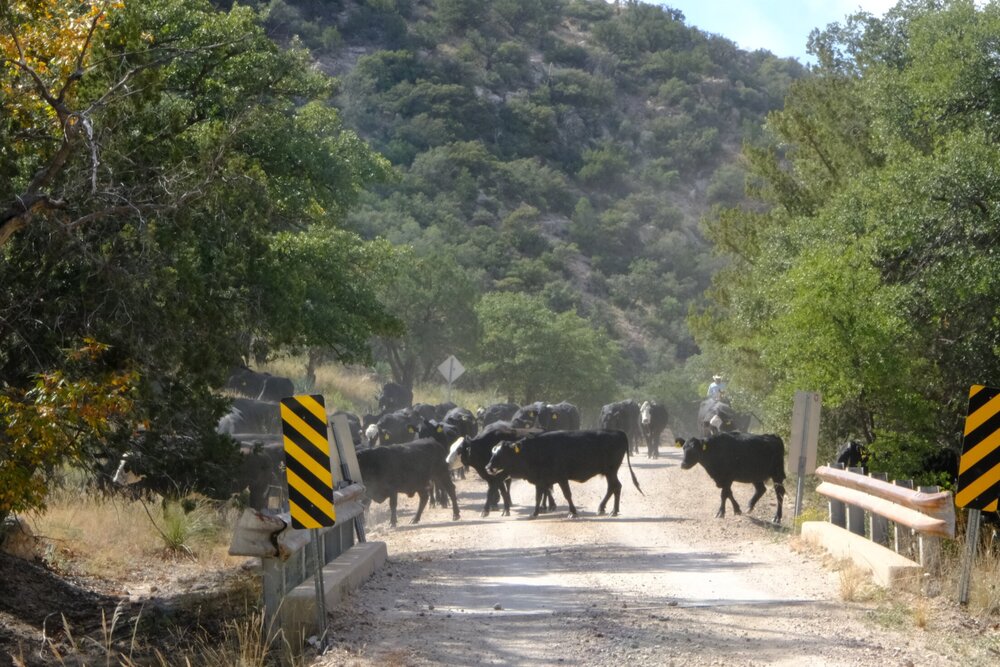
Rush hour on FR 42.
As you head up into the mountains, take your time soaking in the incredible views overlooking the basin-and-range region of southeastern Arizona. At 12 miles in, you reach Onion Saddle at 7,600 feet elevation. I’d recommend taking the FR 42D spur and make your way up to 8,500 feet to check out Barefoot and Rustler Park. Named for rustlers around the turn of the century who hid their stolen cattle in this alpine meadow, Rustler Park has hiking trails that lead off into the wilderness, a nice Forest Service campground, and a lovely spattering of seasonal wildflowers.
After Onion Saddle on FR 42, you’ll begin the descent towards the town of Portal. The views to the east are just as spectacular as the western ones you saw on your way up. Any lingering thoughts you may have about Arizona being just a sandy, cactus-studded desert will be finally laid to rest. As the drive winds down after ten more miles of gravel, you’ll find a few more Forest Service campgrounds nestled into the canyon and you’ll be back on pavement in Cave Creek Canyon. The canyon is certainly one of the highlights of the Chiricahua range and as you gaze up at the stunning rhyolite cliffs, it will become abundantly clear how the area got its nickname, “Yosemite of Arizona.”
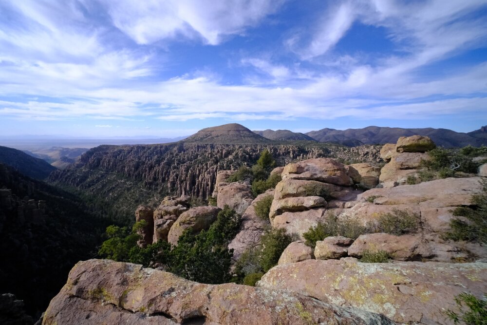
Looking west from Chiricahua National Monument.
One of the best ways to OTA is to make it about more than just the drive. Whether you bring hiking shoes or your birding binoculars along on your visit to the Chiricahuas, you’ll be met with a wealth of options for side hustle adventures.
If you’re looking for hiking, this whole drive is loaded with trailheads leading out into the Chiricahua Mountains. Or, prior to setting out on FR 42, head up into Chiricahua National Monument. The drive into the monument, Bonita Canyon Drive, is beautiful and incredibly scenic as it winds up to 6,800 feet at Massai Point. The views are spectacular the whole way up and the hiking in the monument is wonderful. I’m particularly fond of The Big Loop, possibly my favorite 10-mile hike in the state outside of the Grand Canyon.
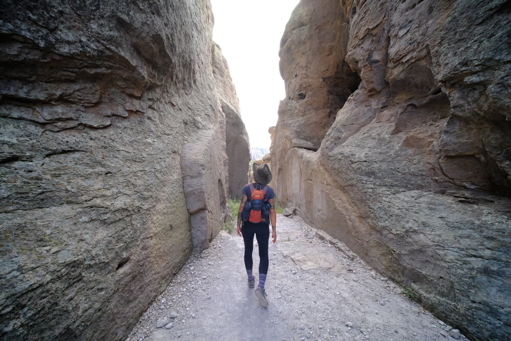
Hiking The Big Loop in the monument.
When it comes to nature, birding and wildlife, the Chiricahuas do not disappoint. This is the sky islands region and it is the convergence of the Rocky Mountains, Sierra Madre, Sonoran Desert, and Chihuahuan Desert. You’ll find more unique species of birds, animals, and plants than almost anywhere else in the whole country. Birders flock to the area to catch a glimpse of the elegant trogon and migrating tropical hummingbirds. Bear, javelina, and coatimundi are common sights.
Between the alpine landscape, the variety of riding, and all the great hiking, the Chiricahua Mountains are one of those places I return to again and again. If you find yourself in southeastern Arizona, I can’t recommend this region enough for a One Tank Adventure. You might even enjoy it so much that you’ll be tempted to make it a two-tank adventure.
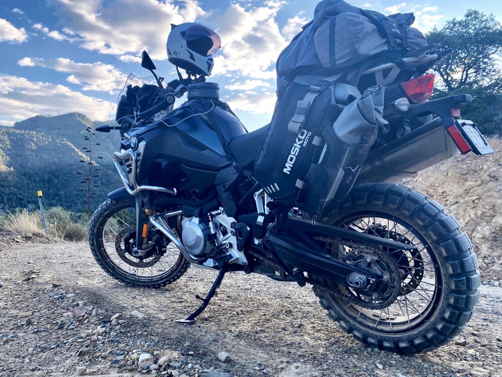
Fresh Shinko tires and fading fall light.
WHAT TO KNOW:
Time: One day
Distance: 24-30 miles
Fuel: Gas is available in McNeal and Sunizona to the west and Rodeo, NM to the east. The closest gas stations will add 15-20 miles to your OTA, be sure to fill up in case you get a hankering to explore beyond FR 42.
Water: Bring more water than you anticipate requiring — the high elevation and the arid desert have a way of drying you out. There is no potable water along this route until you get to Portal.
Permits: No permits are required.
Other considerations: Weather plays a big factor in this region, from fires during the summer to snow in the winter. Check the Forest Service website for updates.