Between the whisperings of a rugged history and the unforgiving landscapes, traveling in the borderlands makes every trip feel especially adventurous. The Geronimo Trail is no exception as it meanders across far southeastern Arizona and western New Mexico.
Though it is not especially challenging, the Geronimo Trail is decidedly remote. Stretching over 80 miles from Douglas, Arizona, to Animas, New Mexico, you’ll feel like you’re in the middle of nowhere as you follow in the footsteps of the Apache Indians, Spanish missionaries, Mormons, and Mexican revolutionaries who passed through this region centuries ago.
As you begin your trip in the small border city of Douglas, stock up on provisions, fresh tortillas, and gas for your journey. Heading east out of town on East 15th Street, the Geronimo Trail begins at the intersection of West Airport Road where the pavement turns into a wide gravel road after about 4 miles.
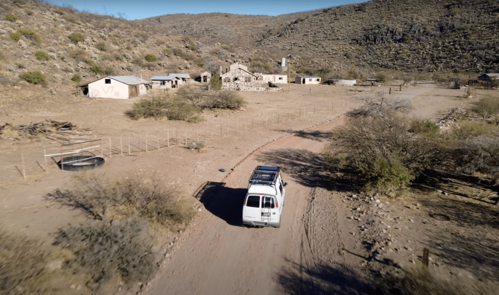
14 miles into the journey, you’ll pass the turnoff to Slaughter Ranch, named for “Texas John” Slaughter who bought 65,000 acres in 1884. Slaughter was the sheriff of Cochise County, Arizona from 1886 through 1890 and is best known for laying down the law in Tombstone and the unruly Arizona Territory.
READ MORE: Trips & Trails: Georgia Traverse
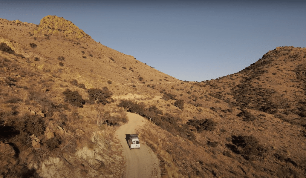
As you make your way towards New Mexico through the San Bernardino Valley of Arizona, the road winds through rugged volcanic rock formations and high desert grasslands into the foothills of the Peloncillo Mountains. As the road gains elevation, the scrub oak and juniper gives way to fantastic views of the surrounding desert.
The Peloncillo Mountains are part of the Madrean Sky Islands region. Referring to isolated mountains surrounded by radically different lowland environments, the Sky Island landscape along the Geronimo Trail is no exception. You’ll meander through canyons, riverbeds, and washes as you climb towards impressive vistas of the surrounding landscape.
After crossing the Arizona-New Mexico border, the Sky Islands give way to vast western ranchlands where you can see for miles in all directions. The road turns back to pavement a few miles from Animas where your journey along the Geronimo Trail comes to an end.
The Geronimo Trail is navigable by most any vehicle during good weather, but I would recommend four-wheel-drive, given the potentially rugged terrain. Also, be aware that cell coverage is spotty at best and often non-existent for much of this drive. There’s a good chance you won’t see another vehicle the entire length of the Geronimo Trail.
Spring and fall are the best times to make this trip, as winter temperature can be freezing and summer temperatures can be in the 100s. Be prepared to carry all the water, food, and tools you’d need to safely make the journey.
WHAT TO KNOW:
- Time: 1-2 Days
- Distance: 80 miles
- Fuel: Gas is available at either end of the route in Douglas, AZ or Animas, NM. Even if you fill up to start, it’s advisable to bring supplementary fuel along just in case.
- Highest elevation: 5700 feet
- Water: Plan for at least two gallons of water per person per day. DO NOT count on finding a natural water source anywhere along this route.
- Permits: No permits are required for the Geronimo Trail.
- Other considerations: Dispersed camping is amply available along the route while on BLM Land. There are no services in this remote region and all the standard rules apply: dispersed camping is allowed free of charge, for up to 14 days in any one spot, and practice LNT every chance you get.


