I looked at the thermostat on the dash of the GMC Sierra AT4X, it read 110 degrees Fahrenheit. Still. Out across the barren red rock landscape, there wasn’t a cloud in the sky and I could see heat waves rippling over the sandstone.
Who in their right mind thought it was a good idea to go camping in conditions like this?
Ultimately, I guess it was mine. Usually, I spend about 30 days camping in the Beehive State each year. Starting out exploring the southern red rock country in the spring, getting pushed up into the cool mountain air during the summer, and then out into the west deserts in the fall. But when someone offers you the keys to a brand spanking new truck and tells you to go take it out on one of the most iconic trails in the West, you say “Absolutely.”
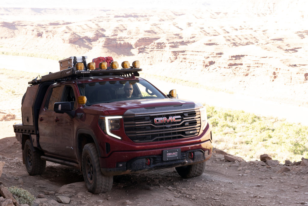
The catch was the reservation for the White Rim Road was in early August. The absolute hottest time of year in southeastern Utah. But that’s fine, as long as you’ve got top notch A/C in your vehicle, which I can attest that the Sierra does in addition to air-conditioned seats.
Our journey began on Thursday morning as we slogged our way through traffic in the ever more crowded Salt Lake and Utah valleys before winding our way through scenic Spanish Fork Canyon and down along the edge of the Book Cliffs to Green River, Utah.
Green River’s heyday was 50 years ago when the U.S. Army operated a missile test launch site outside of town. For a solid ten years, residents watched Athena and Pershing missiles streak through the sky to White Sands Missile Base in New Mexico. The small farming community grew to support the base and its population. But when the missiles stopped firing in 1975, the town dwindled. All along the main drag there are the remnants of old hotels, banks, and restaurants. Sitting brightly amongst the faded glory is Ray’s Tavern, which is a respite for tired travelers looking for the finest burger in the West.
My two companions, Scott Curtis and Chris Nielsen (the only people brave enough to face the heat), and I found a quiet booth in the back of Rays and ordered a round of burgers. We were running a bit ahead of schedule and over lunch we opted to explore some of the area south of Green River that we hadn’t been to for probably a decade.
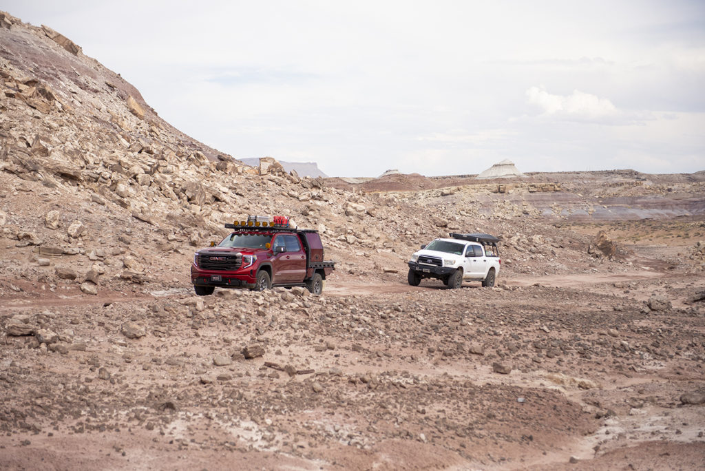
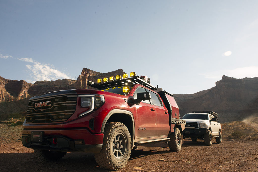
Refreshed from our meal, we loaded up into the AT4X, along with Scott’s Tundra, and headed south under I-70. Our first stop was the location of the base barracks, which today is just rows of concrete pads in remarkably great condition. Some of these had wooden buildings on them, but most were just tents. Standing there in 100-degree heat you can only imagine how miserable it must have been living in those heavy canvas tents.
Next we meandered for a bit on some two-track and descended into a small valley that had the remains of an observation tower and a storage paddock. We hopped out again and poked around a bit. We’d all been to the area many times over the years, but none of us could remember seeing this before. It always amazes me the strange things you can find hiding in the desert.
Finally, we made our way up to the old Pershing launch site. Pershing missiles were Medium-Range Ballistic Missiles deployed by the United States in the 1960s. As opposed to the Athena missiles also tested at Green River which fired from a permanent launch site, the Pershing’s were launched from mobile Transporter Erector Launchers (TEL). These tracked vehicles would move into position, raise the missile into its launch position, and fire. Their test launch location consists of two pads where the TEL and support vehicles would position themselves, and a bunker where personnel would hunker down during the launch in case there were any malfunctions (i.e. unplanned explosions).
All of this is still there, but to someone who didn’t know what it was, they’d probably just see strange mounds of dirt and an odd looking dugout. We poked around the site for a bit before finally heading back to the county gravel road and I-70. It was time to make our way to our first camp on the White Rim.
When I first attended the Moab Easter Jeep Safari with my dad in 1993 at the impressionable age of 10 I was in awe as we turned off I-70 onto US-191. The change of scenery from Price to Green River is spectacular. But as you head south on 191 towards Moab and the red rocks start to come into view – it’s magical. To this day it still brings a smile to my face, even though 191 has changed from a lonely road to a dusty old mining town into a busy thoroughfare for thrill seekers. We trundled along with all the other cars streaming to this mecca of outdoor adventuring until we got to the turnoff for Dead Horse Point.
Dead Horse Point Road, or Highway 313, is another magnificent drive through beautiful country. It is also a dream road in a Miata. Not so much in the Sierra. While the AT4X handles well, and has gobs of power, it’s still a full-size truck. You can’t apex it quite like you can a sprightly little sports car, try as I might.
We finally hit dirt at about 6:00 p.m. high above the famed Shafer Switchbacks. We parked at an overlook and gazed down 1,500 feet to the bottom. You could see the road clinging to the side of the canyon all the way down. Originally a trail built by sheep herders in the area, the demands of uranium mining in the 1950s improved the road to what we know today, just like nearly all the major 4-wheel drive trails around Moab.
In all the years I’ve been coming down to this area, I’ve never actually driven down the switchbacks, always up. And always in a much smaller vehicle, like a Samurai or Trooper. Not this 80-inch-wide GMC. No matter though, I knew that what the White Rim had in store later in the weekend would make these switchbacks look like I-15. We let a few cars we saw coming up the road pass us and then we started our journey down. Aside from having to make a few three point turns at some of the hairpins, it was an uneventful journey. We stopped at the bottom and gazed up to the top again marveling at what it must have taken to build the road with pick ax, shovel, and brute strength.
Our first camp on the White Rim was appropriately named Shafer Campground just a few miles down the road from the switchbacks. It was a perfectly acceptable campground. Chris and I found good spots to deploy our ground tents while Scott leveled out his Tundra for his plush and luxurious rooftop tent. After our sleeping situation was sorted, we got to the most important part of camp: beer, food, and telling tales.
Descent into Hell & Spectacular Vistas
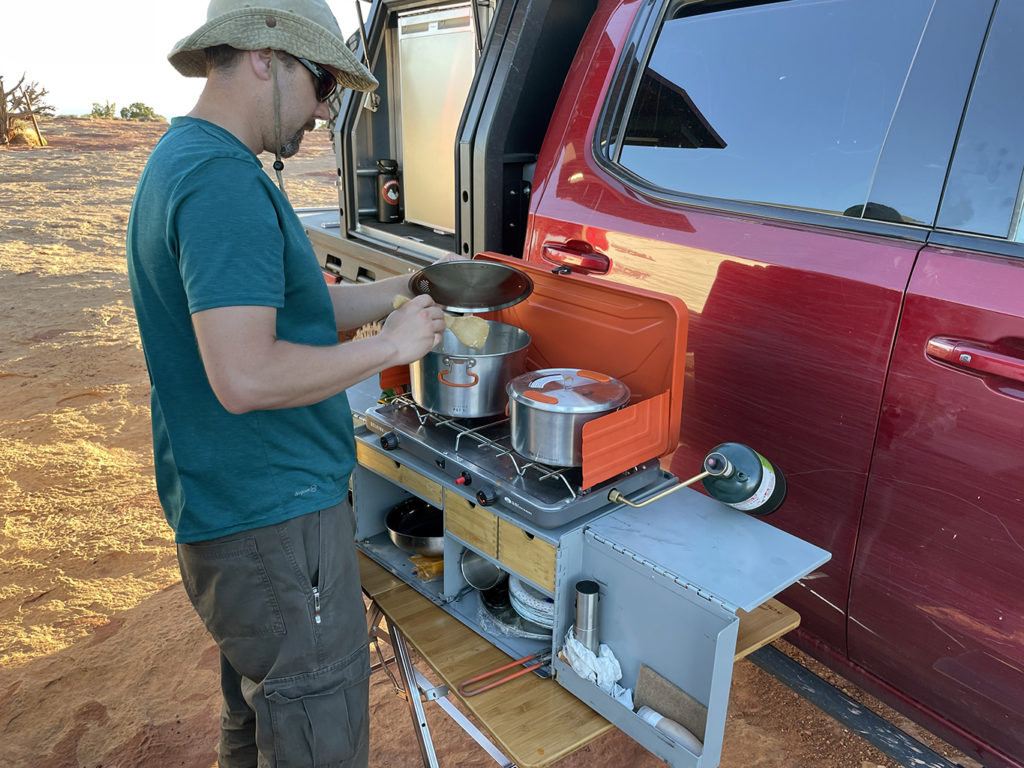
The next day we rose with the sun. So 5:30 a.m. Chris already had his signature French pressed coffee going and we sat around sipping it while I whipped up some oatmeal. I love that people go all-in for camp breakfast. I’ve always been of the mindset, though, that I want mine to be quick and simple, so I can hit the trail without having to bother with too much clean-up.
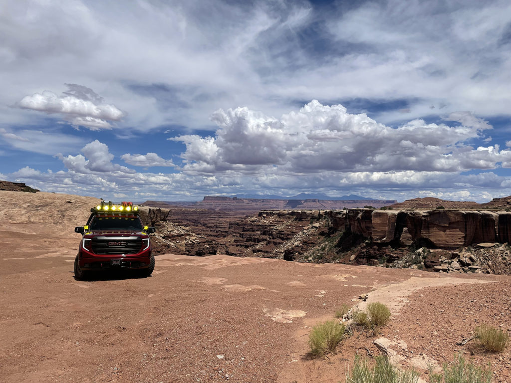
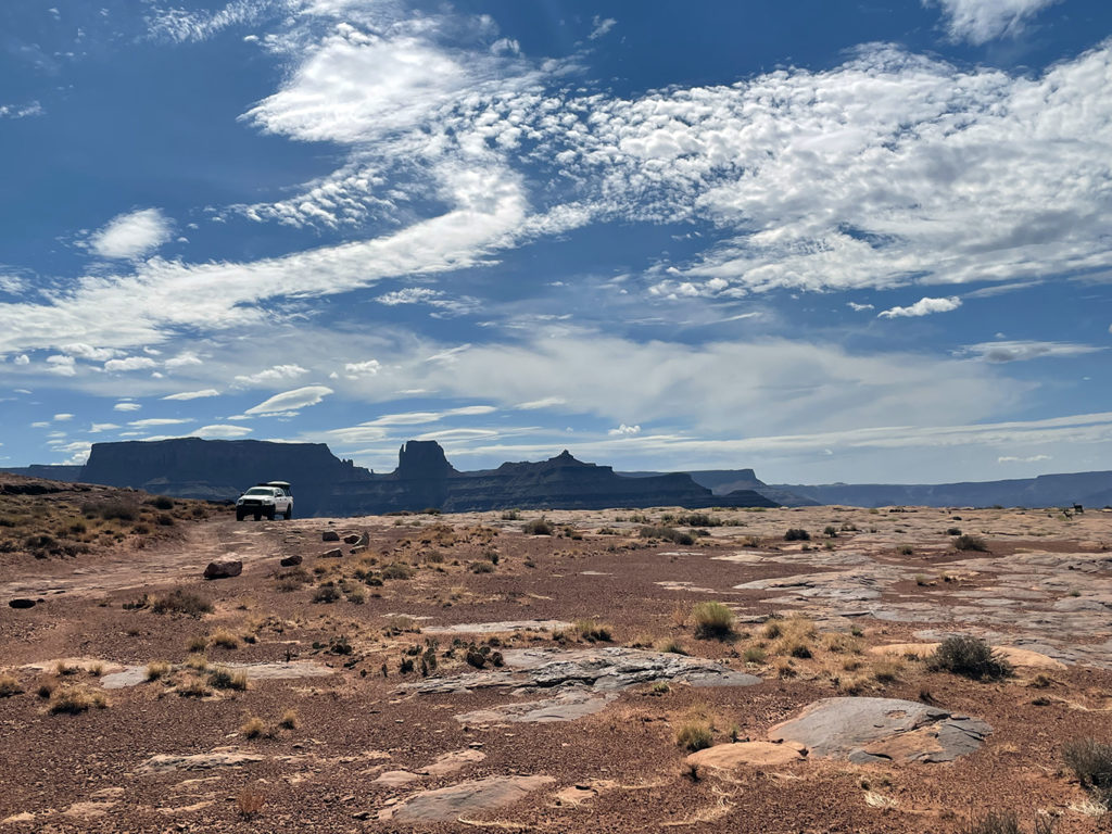
By about 7:00 a.m. we had camp packed and we were on our way. The first part of the eastern side of the White Rim Trail meanders high on a plateau above the Colorado River. We stopped at a few of the overlooks and enjoyed the smooth ride in the AT4X. Eventually we got to the turnoff for Lathorp Canyon. The National Park Service calls this an “extreme” trail, which is just the kind of action we were looking for.
As we eased off the White Rim Trail into Lathorp Canyon, this was the first time I really needed to put the Sierra into 4-Low. Nothing difficult, just rocky and steep where the lower gearing helps control the descent. We wound our way further down the canyon and found a couple tight spots that needed some spotting and eventually a nice little ledge climb that justified engaging the lockers for that little extra grip. Most of all though, I found the various cameras on the truck to be the most useful. My regular adventure vehicle is a Y62 Nissan Armada, which isn’t that much narrower than the Sierra. So, I’ve gotten fairly used to navigating a big vehicle on a tight trail. But the front and side cameras make it so much easier.
While the trail got more interesting, the thermostat kept climbing. As the mercury rose further and further above 100, we kept telling ourselves that at the end of the trail was the Colorado River which was sure to offer some respite with its cool waters and a nice breeze. But as we reached the bottom and the temperature ticked up to 109 we got out and walked down to the river bank to find no relief. No cool breeze, no shade. Just heat and bugs. We quickly scarfed down some lunch, waved at some stunned rafters on the river and headed back up the canyon to the White Rim.
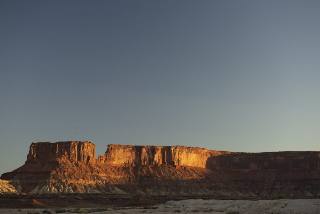
Back on the main road we cruised along at a good pace, but the temperature outside remained stubbornly in the 105 range. It was too hot to enjoy much more than the view from the air conditioned seats of the Sierra. Since we weren’t stopping very often, we ended up making it to our camp at White Crack around 3:00 p.m. and the temperature outside was 110 degrees. We wandered around camp for a minute and found some great shade to sit under and as the afternoon eased into evening, the temperature finally started to fall into the much more enjoyable 90s. We found a hiking trail out to the actual White Crack, which was spectacular.
That night we fired up some chicken tikka masala and garlic naan on the Green Goat camp kitchen and watched the sun set over the stunning canyon below us. And as the night wore on we toasted our adventure with some appropriately named Rendezvous Rye. A perfect ending to a great day.
Pucker Factor
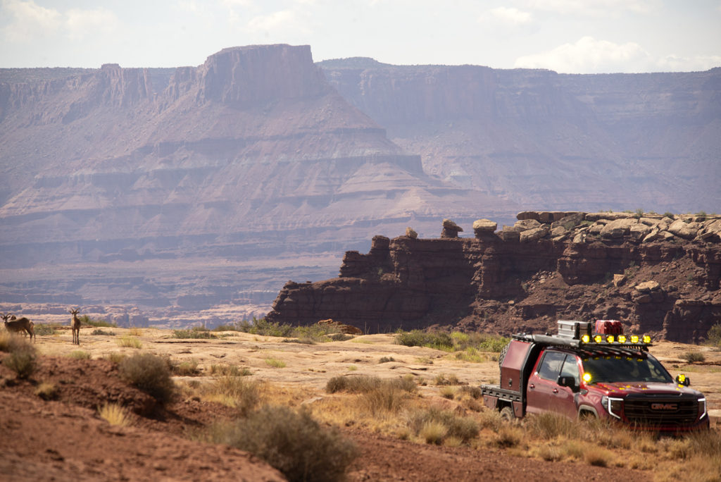
Saturday morning, we rolled out of camp a little later than Friday so we hopefully wouldn’t again reach camp so early. The road started to hug the rim a bit more than it had on Friday and as we wound ourselves along we came across the occasional section that required 4-Low and some careful tire placement, but mostly it was just a bumpy scenic drive. The views were again grade-A and the temperature so far was happily sitting in the 90s.
About mid-day we came around a corner and saw a steep dugway. As we got closer we could see it was quite narrow with loose rock and several nice ledges. There were a couple of hikers making their way up, so we stopped at the bottom for a few minutes to give them time to get to the top. Once they were out of sight I put the AT4X into 4-Low and engaged the front and rear e-lockers and began grinding my way up the hill.
About three quarters of the way up there was a very recent rock slide that probably narrowed the road to all of 90 inches wide. And standing right at the slide were the two hikers filming us. I was annoyed, I didn’t want to stop because when you lose momentum on a climb like this, it spells disaster. I was about to tell Chris to lean out the window and yell at them when I noticed that they were dressed in identical shirts and pants. They were Park Rangers. As I approached the slide and barely squeezed past, they flattened themselves against the wall. We reached the top and quickly got out to make sure Scott made it through the tight spot as well.
Once we were both in clear, the Rangers came over and said they were out doing a road inspection and they got video of us to tell their superiors that the road was indeed still passable. Because apparently if a behemoth like the Sierra could make it past, then anyone else should have it easy. Which is all fine and dandy, but phew! I wasn’t expecting to serve as the National Park Service’s acid test. Let me tell you, that was about as tight of a squeeze as I can remember driving on the edge of a canyon.
But the fun wasn’t over, about a hundred yards from where be crested onto the top of the ridgeline, the road dropped back off into another canyon. And it was a dramatic drop on another very narrow bit of road that culminates in a series of tight corners and hairpins. It was another moment where the cameras on the truck were worth every penny.
READ MORE: Tails from the Trail: McGrew Trail
From here on the road got generally more difficult. Not rock crawling by any means, just clearly less traveled and requiring a little more thought in your driving. After a couple more hours, we made it to our camp for the light, a place called Candlestick. Its eponymous butte to the northeast was impressive, but the campsite itself was barren and, you guessed it, hot. With several hours of sunlight left and not a tree in sight, we deployed our awnings and did our best to stay cool.
Morning Vistas & Cliffhangers
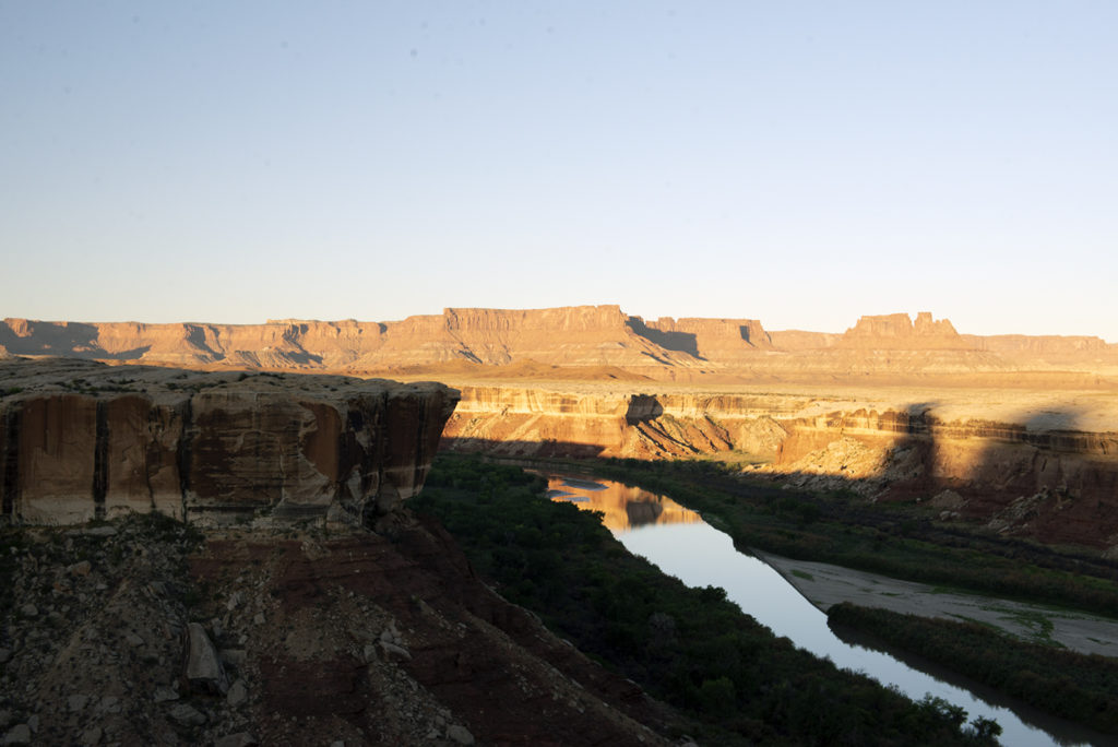
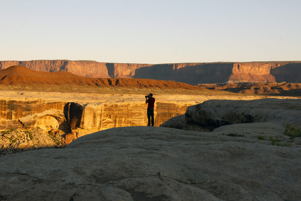
Compared to White Crack the night before, Candlestick was a disappointment. But we assumed that there was a reason that the Park Service had a campsite here. So in the morning Chris and I grabbed our cameras and hiked out to the edge of the canyon overlooking the Green River and waited for the sun to rise. And it did not disappoint. What had been a dull, desolate view lit up with the morning rays into a beautiful vistas full of reds, golds, and greens.
Being Sunday, we got underway fairly early. No matter how enjoyable a trip is, the last day I always look forward to getting home, seeing my family and having a nice shower. We made our way past the Potato Bottom campgrounds and to the climb into Hardscrabble Canyon. This was the only section of the road that the Park Service had said might be impassable due to recent rain. As we approached the switchbacks cut into the loose, white dirt. It certainly looked like it would be the most challenging.
I dropped the AT4X into 4-Low again and engaged the rear locker to ensure I had good traction and began my assent. The ground was loose and I could feel the Firestone Destination M/T2 tires slipping, as they struggled to find traction. While we made our way to the top, there were a couple of tight blind corners that not even the vaunted cameras were much help with. The right rear fender flare tagged a rock. But, finally, we’re at the top — sort of. While the road flattened out, we were now driving on the edge of a mesa’s narrow escarpment before we finally descended into Hardscrabble Canyon.
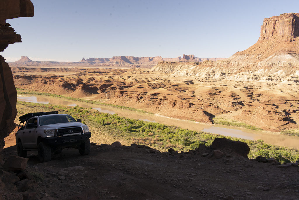
We were now driving right on the banks of the Green River and not much further down the road, we exited the National Park and crossed into Grand County. Here the road also changed into a well maintained, graded road that was smooth and fast. We bombed along until we got to the imposing switchbacks at Mineral Canyon. Short and steep, these switchbacks are wide and well traveled, but if you keep an eye out you can see the remains of a few cars that didn’t make it.
And then we were back on top of the mesa. We cruised down the county road enjoying its width and speed until we reached Highway 313 again. Our trip had come full circle.