At this point, it’s likely even your grandparents have heard of the Mojave Road. It’s ubiquity doesn’t make it unworthy of your attention; it’s a great way for an overlander to cut their teeth — and see some beautiful sights along the way.
The Mojave Road was first blazed by Native Americans in the late 18th century. Over the last three centuries, it’s been utilized by Spanish explorers, Native American tribes, pioneers and settlers, and the US military.
Mojave Road is an east-west route that extends from roughly Searchlight, Nevada to Zzyzx, California (formerly Soda Springs). The track itself isn’t too tough with only a few moderate obstacles along the way. However, its length and extreme temperatures make it a more moderate excursion.
It should not come as a surprise to anyone that the Mojave Road runs through the Mojave Desert. Accordingly, winter temperatures can drop as low as 0 degrees in the mountains and as high as 120 degrees in summer. Summer flash flooding can also occur.
Not only do these extreme conditions make any overland trip unpleasant, the higher temperatures can easily overwhelm older vehicles’ cooling systems. So, take into consideration the condition of your vehicle before attempting this trek.
Given these conditions, Spring is the ideal time to plan a Mojave Road adventure. In April and May, temperatures can range from 48 to 93 degrees, depending on your altitude along the road.
Photo credit: Jarrod Simonetto @jrsimonetto
Although the route is mostly dusty and rocky, it can become slick and muddy after a rainstorm. It is advisable to “inquire about road conditions, especially if you plan to cross Soda Dry Lake,” according to the National Park Service. We recommend you not attempt a crossing when it’s wet.
There are plenty of misleading off-shoots from the Mojave Road which you will not find on the map. Don’t be confused, these are mostly illegal shortcuts or traces of ancient tracks. Ensure you stay on existing open roads and refrain from driving cross country. It is illegal to cut your own path or drive in the washes.
What to know:
Time: 3 days (on average)
Distance: 140 miles
Fuel: Fuel may not be accessible for up to 215 miles (depending on route). Top off your jerrycans before you hit the road.
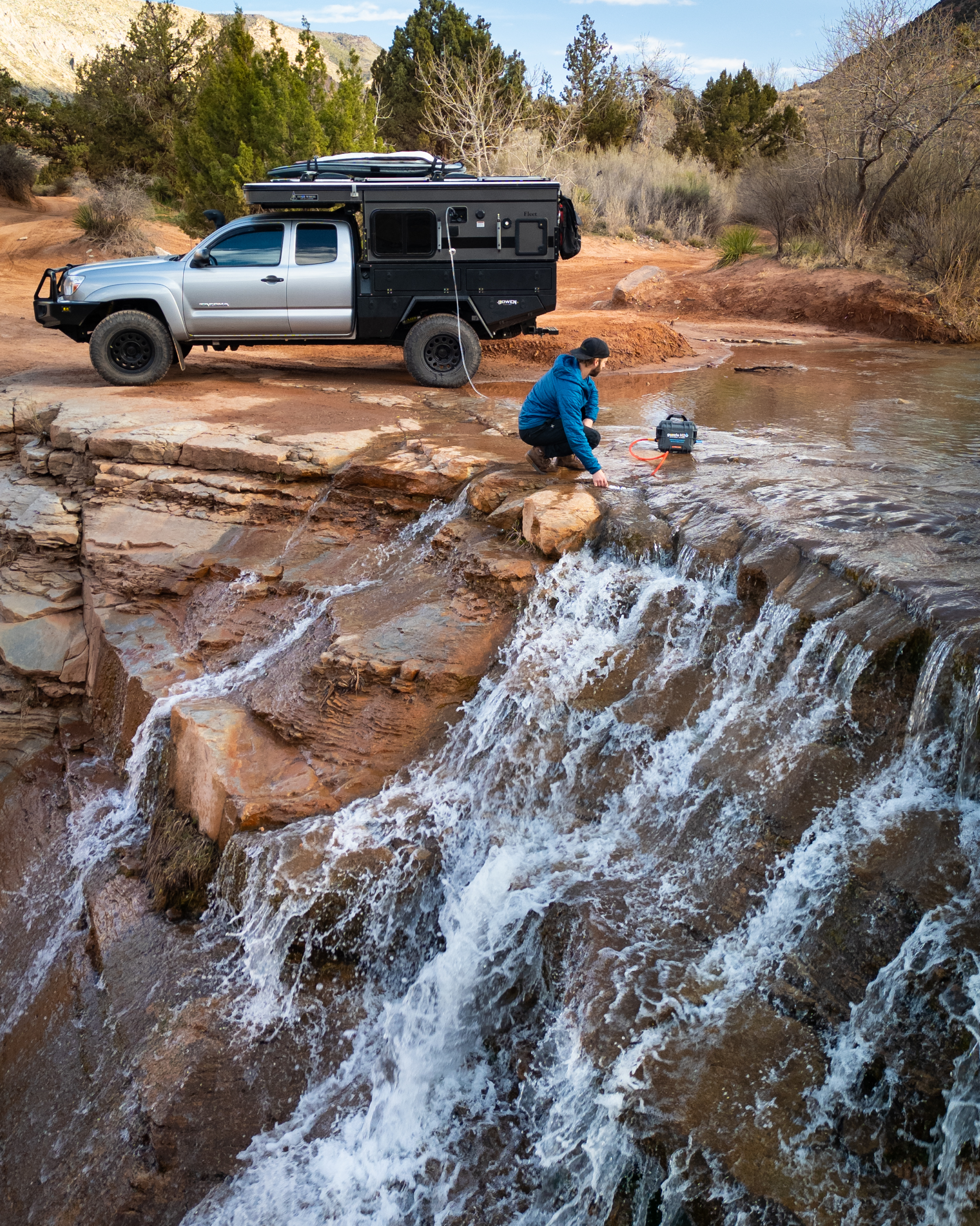
Water: Water sources, formerly protected by Military forts, can be found along the route every 20 to 30 miles. Regardless, bring plenty with you and pack a water filtration solution just in case.
Permits: A California campfire permit is required for all open fires. No permits are required for driving. However, vehicles must be street legal.
Other considerations: Winter temperatures can drop to 0 degrees. Summer temperatures can climb to 120 degrees.
Header image: Ian Matyssik @matyssik | Upsplash