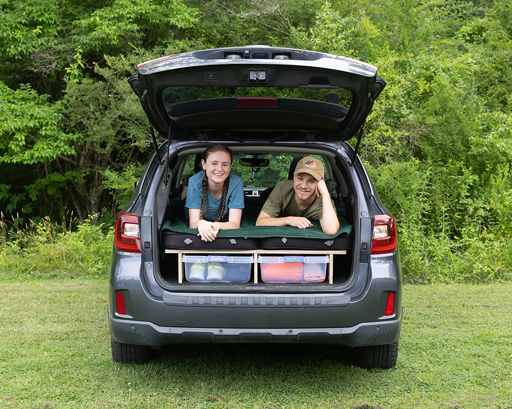
The Santa Rita Mountains are located in the Coronado National Forest in south central Arizona, just north of the Mexican border. They’re zigzagged with a series of winding, mountainous trails. The trails vary in length and difficulty. None is long enough in and of itself to make a full trip out of. However, you could string together a couple to make for a several-day trip.
Of the multitude of trails, we selected two of onX Off-Road’s Highlighted trails that we feel exemplify the trails in the region. There is a nearby town, Green Valley. However, the region is very remote. Be sure to travel prepared with self-recovery gear and extra supplies.
Gardner Canyon
The Coronado National Forest is scattered with mesquite, scrub oak, tall grass, and cacti. It’s a beautiful part of the southwest.
Along the track, you’ll pass Kentucky Camp. Constructed in 1904, Kentucky Camp was the headquarters for the Santa Rita Water Company. Today’s facilities include the surviving headquarters building, a guest cabin, and historical adobe ruins. The area is popular for hiking, mountain biking, horseback riding and backroad exploration.
READ MORE: What to Bring Overlanding
The Gardner Canyon trail is a lovely track that offers great views at every turn. Plus, it offers additional sights not accessible by vehicle. Throw your rig into park and hoof it up the road to Kentucky Camp (the road is closed to motor vehicles). And you’ll find some fascinating adobe ruins.
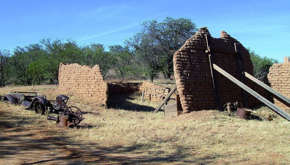
Remnants of Kentucky Camp | Photo: onX Off-Road
You can drive straight through or extend your drive a bit; Gardner Canyon Road offers camping spots. We recommend taking your time to explore the numerous side roads that snake off this particular track. Just make sure you stay on a legal route.
To get to the trail, take Interstate 10 east from the south side of Tucson to Exit 281. Follow Highway 83 south about 21 miles. Turn right 0.7 miles south of mile marker 38 on well-marked Gardner Canyon Road.
onX rates this trail as a ‘moderate’ 4/10 on the difficulty scale. It is an uneven, rutted dirt trail with loose rocks, sand, erosion, and washes. There are potential water crossings up to a foot deep, mud holes, and obstacles up to 18 inches, including ledges and short, steep grades. Roads are typically single width with places to pass. Most of the trail is packed dirt road. The trail gets narrow and steep with several rocky hills after
WHAT TO KNOW:
Time: 3 hours
Distance: 22.1 miles
Fuel: There are a couple gas stations in Green Valley to the northeast of the Coronado National Forest. Even if you fill up there, it’s advisable to bring a couple gallons of fuel along just in case.
Highest elevation: 5,887 feet
Water: Although there may be water along the route, don’t rely it as your only water source. Plan to carry your own water. Plan for one gallon of water per person per day.
Permits: Permits are not required.
Other considerations: The cooler months, in winter and spring, make for the most pleasant times of year to visit this region.
Bull Springs Road
Experienced drivers will find this trail easy. However, it has its share of rough sections. What’s more, it is extremely remote. You’ll cross through ranch land and wind up in the Coronado National Forest. From there, you climb the lower part of the Santa Rita Mountains up to 5,000 feet.
Along the road, you’ll pass Alto. It was an early mining camp started by mining engineer Josiah Bond. A Post Office was established there June 6, 1912. Bond’s wife, Minnie, was the postmistress. The Alto ruins include a few adobe walls of what was once the Post Office and possibly part of the family residence.
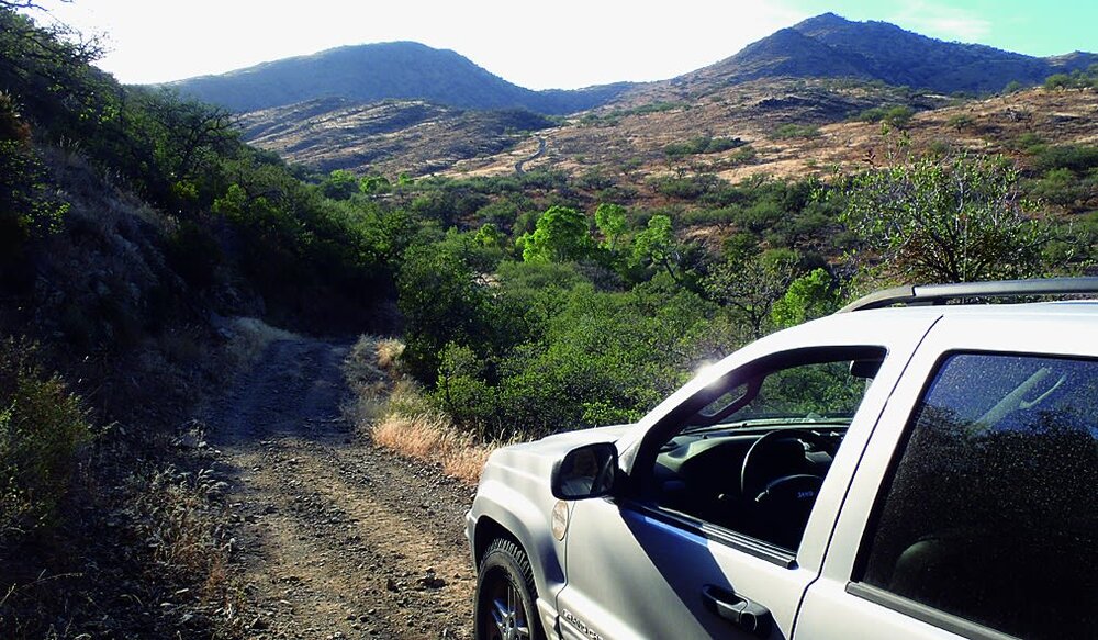
Photo: onX Off-Road
To get to Bull Springs Road, take Interstate 19 south. Take at Exit 48. Then head north on E Frontage road for 1.8 miles to Elephant Head Road. It’ll be on the right. Head east 1.5 miles. Then turn right on Mt. Hopkins Road. Follow this road southeast 4.8 miles to Bull Springs Road on right.
If you take Exit 56, Elephant Head Road is 3.2 miles south.
onX rates this track an ‘easy’ 4/10 on the difficulty scale. It is an uneven, rutted dirt trail with loose rocks, sand, visible erosion, and washes. Depending on the time of year, you’ll encounter potential water crossings up to a foot deep, mud holes, and obstacles up to 18 inches. These include ledges and short, steep grades. Roads are typically single vehicle width. However, there are places to pass.
There are a few steep spots with ruts and minor rocky sections. Conditions subject to change following heavy rains. Four-wheel drive and high clearance are definitely needed.
WHAT TO KNOW:
Time: 4 hours
Distance: 26.1 miles
Fuel: There are a couple gas stations in Green Valley to the northeast of the Coronado National Forest. Even if you fill up there, it’s advisable to bring a couple gallons of fuel along just in case.
Highest elevation: 5,190 feet
Water: Although there may be water along the route, don’t rely it as your only water source. Plan to carry your own water. Plan for one gallon of water per person per day.
Permits: Permits are not required.
Other considerations: The cooler months, in winter and spring, make for the most pleasant times of year to visit this region.